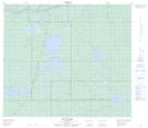
Maps showing Ipiatik Lake, 72,73-7-W4, Alberta
Ipiatik Lake is a Lake located in 72,73-7-W4, Alberta and has an elevation of 679 meters.
- Latitude: 55° 17' 22'' North (decimal: 55.2894444)
- Longitude: 111° 3' 11'' West (decimal: -111.0530555)
- Topography Feature Category: Lake
- Geographical Feature: Lake
- Canadian Province/Territory: Alberta
- Elevation: 679 meters
- Location: 72,73-7-W4
- Atlas of Canada Locator Map: Ipiatik Lake
- GPS Coordinate Locator Map: Ipiatik Lake Lat/Long
Ipiatik Lake NTS Map Sheets