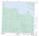
Maps showing Jackfish Point, 123-4-W6, Alberta
Jackfish Point is a Cape located in 123-4-W6, Alberta.
- Latitude: 59° 40' 43'' North (decimal: 59.6786110)
- Longitude: 118° 35' 30'' West (decimal: -118.5916666)
- Topography Feature Category: Cape
- Geographical Feature: Point
- Canadian Province/Territory: Alberta
- Location: 123-4-W6
- Atlas of Canada Locator Map: Jackfish Point
- GPS Coordinate Locator Map: Jackfish Point Lat/Long
Jackfish Point NTS Map Sheets