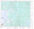
Maps showing Jackson Lake, 67-10,11-W4, Alberta
Jackson Lake is a Lake located in 67-10,11-W4, Alberta and has an elevation of 635 meters.
- Latitude: 54° 48' 47'' North (decimal: 54.8130555)
- Longitude: 111° 32' 39'' West (decimal: -111.5441666)
- Topography Feature Category: Lake
- Geographical Feature: Lake
- Canadian Province/Territory: Alberta
- Elevation: 635 meters
- Location: 67-10,11-W4
- Atlas of Canada Locator Map: Jackson Lake
- GPS Coordinate Locator Map: Jackson Lake Lat/Long
Jackson Lake NTS Map Sheets