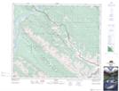
Maps showing Jacques Pass, 46-28-W6, Alberta
Jacques Pass is a Valley located in 46-28-W6, Alberta and has an elevation of 1910 meters.
- Latitude: 53° 0' 33'' North (decimal: 53.0091666)
- Longitude: 117° 56' 40'' West (decimal: -117.9444443)
- Topography Feature Category: Valley
- Geographical Feature: Pass
- Canadian Province/Territory: Alberta
- Elevation: 1910 meters
- Location: 46-28-W6
- Atlas of Canada Locator Map: Jacques Pass
- GPS Coordinate Locator Map: Jacques Pass Lat/Long