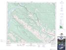
Maps showing Roche Jacques, 47-28-W5, Alberta
Roche Jacques is a Mountain located in 47-28-W5, Alberta and has an elevation of 2281 meters.
- Latitude: 53° 2' 27'' North (decimal: 53.0408333)
- Longitude: 117° 57' 39'' West (decimal: -117.9608332)
- Topography Feature Category: Mountain
- Geographical Feature: Roche
- Canadian Province/Territory: Alberta
- Elevation: 2281 meters
- Location: 47-28-W5
- Atlas of Canada Locator Map: Roche Jacques
- GPS Coordinate Locator Map: Roche Jacques Lat/Long