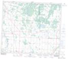
Maps showing Jarvie, 15-63-27-W4, Alberta
Jarvie is a Unincorporated area located in 15-63-27-W4, Alberta and has an elevation of 617 meters.
- Latitude: 54° 27' 17'' North (decimal: 54.4547221)
- Longitude: 113° 59' 13'' West (decimal: -113.9869443)
- Topography Feature Category: Unincorporated area
- Geographical Feature: Hamlet
- Canadian Province/Territory: Alberta
- Elevation: 617 meters
- Location: 15-63-27-W4
- Atlas of Canada Locator Map: Jarvie
- GPS Coordinate Locator Map: Jarvie Lat/Long