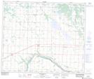
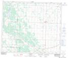
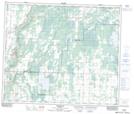
Maps showing Namepi Creek, 24-58-19-W4, Alberta
Namepi Creek is a River located in 24-58-19-W4, Alberta and has an elevation of 640 meters.
- Latitude: 54° 1' 41'' North (decimal: 54.0280555)
- Longitude: 112° 50' 59'' West (decimal: -112.8497222)
- Topography Feature Category: River
- Geographical Feature: Creek
- Canadian Province/Territory: Alberta
- Elevation: 640 meters
- Location: 24-58-19-W4
- Atlas of Canada Locator Map: Namepi Creek
- GPS Coordinate Locator Map: Namepi Creek Lat/Long
Namepi Creek NTS Map Sheets