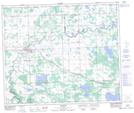
Maps showing Cherhill, 9-56-5-W5, Alberta
Cherhill is a Unincorporated area located in 9-56-5-W5, Alberta and has an elevation of 725 meters.
- Latitude: 53° 49' 9'' North (decimal: 53.8191666)
- Longitude: 114° 40' 38'' West (decimal: -114.6772221)
- Topography Feature Category: Unincorporated area
- Geographical Feature: Hamlet
- Canadian Province/Territory: Alberta
- Elevation: 725 meters
- Location: 9-56-5-W5
- Atlas of Canada Locator Map: Cherhill
- GPS Coordinate Locator Map: Cherhill Lat/Long
Cherhill NTS Map Sheets