Canada Topographic Maps

Chestermere Lake Topo Maps

Topography maps and Latitude/Longitude Location

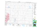
Maps showing Chestermere Lake, Alberta

Chestermere Lake is a Village located in Alberta.

  • Latitude: 51° 2' North   (decimal: 51.0332999)
  • Longitude: 113° 49' West   (decimal: -113.8167000)
  • Topography Feature Category: Village
  • Geographical Feature: Summer Village
  • Canadian Province/Territory: Alberta
  • GPS Coordinate Locator Map: Chestermere Lake Lat/Long

Chestermere Lake NTS Map Sheets

082P04 Dalroy Topographic Map at 1:50,000 scale

082P Drumheller Topographic Map at 1:250,000 scale

 
Buy Topographic Maps DVD
Newsletter Sign-up

Yes, I want to receive map store discounts.


Bookmark and Share