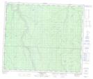
Maps showing Chinook Creek, 66-13-W6, Alberta
Chinook Creek is a River located in 66-13-W6, Alberta and has an elevation of 835 meters.
- Latitude: 54° 43' 38'' North (decimal: 54.7272222)
- Longitude: 119° 56' 51'' West (decimal: -119.9474999)
- Topography Feature Category: River
- Geographical Feature: Creek
- Canadian Province/Territory: Alberta
- Elevation: 835 meters
- Location: 66-13-W6
- Atlas of Canada Locator Map: Chinook Creek
- GPS Coordinate Locator Map: Chinook Creek Lat/Long
Chinook Creek NTS Map Sheets