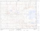
Maps showing Clear Water Lake, 36-12-3,4-W4, Alberta
Clear Water Lake is a Lake located in 36-12-3,4-W4, Alberta and has an elevation of 753 meters.
- Latitude: 50° 2' 31'' North (decimal: 50.0419444)
- Longitude: 110° 25' 7'' West (decimal: -110.4186111)
- Topography Feature Category: Lake
- Geographical Feature: Lake
- Canadian Province/Territory: Alberta
- Elevation: 753 meters
- Location: 36-12-3,4-W4
- Atlas of Canada Locator Map: Clear Water Lake
- GPS Coordinate Locator Map: Clear Water Lake Lat/Long
Clear Water Lake NTS Map Sheets