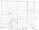
Maps showing Surprise Hill, 31-17-W4, Alberta
Surprise Hill is a Mountain located in 31-17-W4, Alberta and has an elevation of 902 meters.
- Latitude: 51° 40' 45'' North (decimal: 51.6791666)
- Longitude: 112° 23' 13'' West (decimal: -112.3869444)
- Topography Feature Category: Mountain
- Geographical Feature: Hill
- Canadian Province/Territory: Alberta
- Elevation: 902 meters
- Location: 31-17-W4
- Atlas of Canada Locator Map: Surprise Hill
- GPS Coordinate Locator Map: Surprise Hill Lat/Long
Surprise Hill NTS Map Sheets