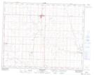
Maps showing Swalwell, 9-30-24-W4, Alberta
Swalwell is a Unincorporated area located in 9-30-24-W4, Alberta and has an elevation of 895 meters.
- Latitude: 51° 33' 26'' North (decimal: 51.5572222)
- Longitude: 113° 19' 6'' West (decimal: -113.3183332)
- Topography Feature Category: Unincorporated area
- Geographical Feature: Hamlet
- Canadian Province/Territory: Alberta
- Elevation: 895 meters
- Location: 9-30-24-W4
- Atlas of Canada Locator Map: Swalwell
- GPS Coordinate Locator Map: Swalwell Lat/Long
Swalwell NTS Map Sheets