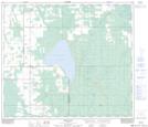
Maps showing Sweathouse Creek, 69-19-W5, Alberta
Sweathouse Creek is a Unincorporated area located in 69-19-W5, Alberta.
- Latitude: 55° 0' 48'' North (decimal: 55.0133332)
- Longitude: 116° 52' 55'' West (decimal: -116.8819444)
- Topography Feature Category: Unincorporated area
- Geographical Feature: Locality
- Canadian Province/Territory: Alberta
- Location: 69-19-W5
- Atlas of Canada Locator Map: Sweathouse Creek
- GPS Coordinate Locator Map: Sweathouse Creek Lat/Long
Sweathouse Creek NTS Map Sheets