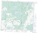
Maps showing Sylvan Glen, 30-64-26-W4, Alberta
Sylvan Glen is a Unincorporated area located in 30-64-26-W4, Alberta and has an elevation of 702 meters.
- Latitude: 54° 33' 28'' North (decimal: 54.5577777)
- Longitude: 113° 54' 20'' West (decimal: -113.9055556)
- Topography Feature Category: Unincorporated area
- Geographical Feature: Locality
- Canadian Province/Territory: Alberta
- Elevation: 702 meters
- Location: 30-64-26-W4
- Atlas of Canada Locator Map: Sylvan Glen
- GPS Coordinate Locator Map: Sylvan Glen Lat/Long