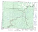
Maps showing Sylvester, 19-69-11-W6, Alberta
Sylvester is a Unincorporated area located in 19-69-11-W6, Alberta and has an elevation of 764 meters.
- Latitude: 54° 59' 44'' North (decimal: 54.9955555)
- Longitude: 119° 40' 52'' West (decimal: -119.6811110)
- Topography Feature Category: Unincorporated area
- Geographical Feature: Locality
- Canadian Province/Territory: Alberta
- Elevation: 764 meters
- Location: 19-69-11-W6
- Atlas of Canada Locator Map: Sylvester
- GPS Coordinate Locator Map: Sylvester Lat/Long
Sylvester NTS Map Sheets