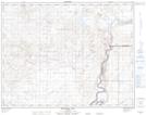
Maps showing Juniper Flats, 17-5,6-W4, Alberta
Juniper Flats is a Beach located in 17-5,6-W4, Alberta and has an elevation of 656 meters.
- Latitude: 50° 27' 48'' North (decimal: 50.4633333)
- Longitude: 110° 40' 4'' West (decimal: -110.6677777)
- Topography Feature Category: Beach
- Geographical Feature: Flats
- Canadian Province/Territory: Alberta
- Elevation: 656 meters
- Location: 17-5,6-W4
- Atlas of Canada Locator Map: Juniper Flats
- GPS Coordinate Locator Map: Juniper Flats Lat/Long
Juniper Flats NTS Map Sheets