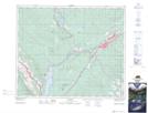
Maps showing Wildhorse Lakes, 49-26-W5, Alberta
Wildhorse Lakes is a Lake located in 49-26-W5, Alberta and has an elevation of 1159 meters.
- Latitude: 53° 16' 13'' North (decimal: 53.2702778)
- Longitude: 117° 47' 44'' West (decimal: -117.7955556)
- Topography Feature Category: Lake
- Geographical Feature: Lakes
- Canadian Province/Territory: Alberta
- Elevation: 1159 meters
- Location: 49-26-W5
- Atlas of Canada Locator Map: Wildhorse Lakes
- GPS Coordinate Locator Map: Wildhorse Lakes Lat/Long