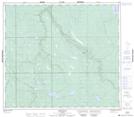
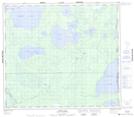
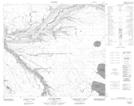
Maps showing Cartwright Bay, 86-4-W4, Alberta
Cartwright Bay is a Bay located in 86-4-W4, Alberta and has an elevation of 457 meters.
- Latitude: 56° 29' 42'' North (decimal: 56.4949999)
- Longitude: 110° 30' 00'' West (decimal: -110.4999999)
- Topography Feature Category: Bay
- Geographical Feature: Bay
- Canadian Province/Territory: Alberta
- Elevation: 457 meters
- Location: 86-4-W4
- Atlas of Canada Locator Map: Cartwright Bay
- GPS Coordinate Locator Map: Cartwright Bay Lat/Long
Cartwright Bay NTS Map Sheets