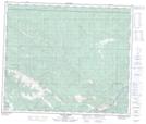
Maps showing Copton Ridge, 60-10-W6, Alberta
Copton Ridge is a Mountain located in 60-10-W6, Alberta and has an elevation of 1287 meters.
- Latitude: 54° 10' 2'' North (decimal: 54.1672222)
- Longitude: 119° 23' 4'' West (decimal: -119.3844443)
- Topography Feature Category: Mountain
- Geographical Feature: Ridge
- Canadian Province/Territory: Alberta
- Elevation: 1287 meters
- Location: 60-10-W6
- Atlas of Canada Locator Map: Copton Ridge
- GPS Coordinate Locator Map: Copton Ridge Lat/Long
Copton Ridge NTS Map Sheets