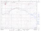
Maps showing Nemiskam, 22-6-10-W4, Alberta
Nemiskam is a Unincorporated area located in 22-6-10-W4, Alberta and has an elevation of 881 meters.
- Latitude: 49° 28' 48'' North (decimal: 49.4799999)
- Longitude: 111° 16' 34'' West (decimal: -111.2761110)
- Topography Feature Category: Unincorporated area
- Geographical Feature: Locality
- Canadian Province/Territory: Alberta
- Elevation: 881 meters
- Location: 22-6-10-W4
- Atlas of Canada Locator Map: Nemiskam
- GPS Coordinate Locator Map: Nemiskam Lat/Long