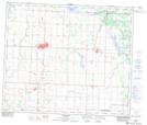
Maps showing Nestow, 31-60-24-W4, Alberta
Nestow is a Unincorporated area located in 31-60-24-W4, Alberta and has an elevation of 636 meters.
- Latitude: 54° 14' North (decimal: 54.2333333)
- Longitude: 113° 36' West (decimal: -113.6000000)
- Topography Feature Category: Unincorporated area
- Geographical Feature: Locality
- Canadian Province/Territory: Alberta
- Elevation: 636 meters
- Location: 31-60-24-W4
- Atlas of Canada Locator Map: Nestow
- GPS Coordinate Locator Map: Nestow Lat/Long