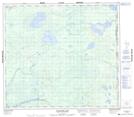
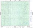
Maps showing Newby River, 81-4-w4, Alberta
Newby River is a River located in 81-4-w4, Alberta and has an elevation of 441 meters.
- Latitude: 56° 1' 53'' North (decimal: 56.0313888)
- Longitude: 110° 31' 44'' West (decimal: -110.5288888)
- Topography Feature Category: River
- Geographical Feature: River
- Canadian Province/Territory: Alberta
- Elevation: 441 meters
- Location: 81-4-w4
- Atlas of Canada Locator Map: Newby River
- GPS Coordinate Locator Map: Newby River Lat/Long
Newby River NTS Map Sheets