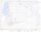
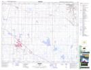
Maps showing Lake Newell, 17-15-W4, Alberta
Lake Newell is a Lake located in 17-15-W4, Alberta and has an elevation of 757 meters.
- Latitude: 50° 26' 4'' North (decimal: 50.4344444)
- Longitude: 111° 56' 6'' West (decimal: -111.9350000)
- Topography Feature Category: Lake
- Geographical Feature: Lake
- Canadian Province/Territory: Alberta
- Elevation: 757 meters
- Location: 17-15-W4
- Atlas of Canada Locator Map: Lake Newell
- GPS Coordinate Locator Map: Lake Newell Lat/Long
Lake Newell NTS Map Sheets