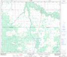
Maps showing New Fish Creek, 12-73-22-W5, Alberta
New Fish Creek is a Unincorporated area located in 12-73-22-W5, Alberta and has an elevation of 644 meters.
- Latitude: 55° 17' 40'' North (decimal: 55.2944444)
- Longitude: 117° 15' 27'' West (decimal: -117.2574999)
- Topography Feature Category: Unincorporated area
- Geographical Feature: Locality
- Canadian Province/Territory: Alberta
- Elevation: 644 meters
- Location: 12-73-22-W5
- Atlas of Canada Locator Map: New Fish Creek
- GPS Coordinate Locator Map: New Fish Creek Lat/Long
New Fish Creek NTS Map Sheets