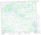
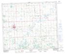
Maps showing Newton Lake, 11-58-2-W5, Alberta
Newton Lake is a Lake located in 11-58-2-W5, Alberta and has an elevation of 662 meters.
- Latitude: 53° 59' 46'' North (decimal: 53.9961111)
- Longitude: 114° 11' 28'' West (decimal: -114.1911111)
- Topography Feature Category: Lake
- Geographical Feature: Lake
- Canadian Province/Territory: Alberta
- Elevation: 662 meters
- Location: 11-58-2-W5
- Atlas of Canada Locator Map: Newton Lake
- GPS Coordinate Locator Map: Newton Lake Lat/Long
Newton Lake NTS Map Sheets