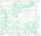
Maps showing Nicholls Creek, 12-74-20-W5, Alberta
Nicholls Creek is a River located in 12-74-20-W5, Alberta and has an elevation of 611 meters.
- Latitude: 55° 23' 55'' North (decimal: 55.3986110)
- Longitude: 116° 56' 7'' West (decimal: -116.9352778)
- Topography Feature Category: River
- Geographical Feature: Creek
- Canadian Province/Territory: Alberta
- Elevation: 611 meters
- Location: 12-74-20-W5
- Atlas of Canada Locator Map: Nicholls Creek
- GPS Coordinate Locator Map: Nicholls Creek Lat/Long