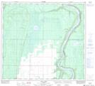
Maps showing Nina Lake, 97-21-W5, Alberta
Nina Lake is a Lake located in 97-21-W5, Alberta and has an elevation of 471 meters.
- Latitude: 57° 25' 13'' North (decimal: 57.4202777)
- Longitude: 117° 17' 50'' West (decimal: -117.2972222)
- Topography Feature Category: Lake
- Geographical Feature: Lake
- Canadian Province/Territory: Alberta
- Elevation: 471 meters
- Location: 97-21-W5
- Atlas of Canada Locator Map: Nina Lake
- GPS Coordinate Locator Map: Nina Lake Lat/Long
Nina Lake NTS Map Sheets