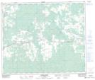
Maps showing Niton Junction, 31-53-12-W5, Alberta
Niton Junction is a Unincorporated area located in 31-53-12-W5, Alberta and has an elevation of 848 meters.
- Latitude: 53° 37' 19'' North (decimal: 53.6219444)
- Longitude: 115° 46' 11'' West (decimal: -115.7697222)
- Topography Feature Category: Unincorporated area
- Geographical Feature: Hamlet
- Canadian Province/Territory: Alberta
- Elevation: 848 meters
- Location: 31-53-12-W5
- Atlas of Canada Locator Map: Niton Junction
- GPS Coordinate Locator Map: Niton Junction Lat/Long
Niton Junction NTS Map Sheets