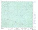
Maps showing Trail Creek, 52-24-W5, Alberta
Trail Creek is a River located in 52-24-W5, Alberta and has an elevation of 1002 meters.
- Latitude: 53° 27' 50'' North (decimal: 53.4639443)
- Longitude: 117° 28' 4'' West (decimal: -117.4677220)
- Topography Feature Category: River
- Geographical Feature: Creek
- Canadian Province/Territory: Alberta
- Elevation: 1002 meters
- Location: 52-24-W5
- Atlas of Canada Locator Map: Trail Creek
- GPS Coordinate Locator Map: Trail Creek Lat/Long