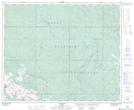
Maps showing Trapper Creek, 48-23-W5, Alberta
Trapper Creek is a River located in 48-23-W5, Alberta and has an elevation of 1350 meters.
- Latitude: 53° 8' 33'' North (decimal: 53.1424999)
- Longitude: 117° 20' 42'' West (decimal: -117.3450000)
- Topography Feature Category: River
- Geographical Feature: Creek
- Canadian Province/Territory: Alberta
- Elevation: 1350 meters
- Location: 48-23-W5
- Atlas of Canada Locator Map: Trapper Creek
- GPS Coordinate Locator Map: Trapper Creek Lat/Long