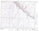
Maps showing Crawling Creek, 26-17-W4, Alberta
Crawling Creek is a River located in 26-17-W4, Alberta and has an elevation of 722 meters.
- Latitude: 51° 13' 37'' North (decimal: 51.2269444)
- Longitude: 112° 15' 30'' West (decimal: -112.2583332)
- Topography Feature Category: River
- Geographical Feature: Creek
- Canadian Province/Territory: Alberta
- Elevation: 722 meters
- Location: 26-17-W4
- Atlas of Canada Locator Map: Crawling Creek
- GPS Coordinate Locator Map: Crawling Creek Lat/Long
Crawling Creek NTS Map Sheets