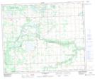
Maps showing Creekland, 12-50-4-W5, Alberta
Creekland is a Unincorporated area located in 12-50-4-W5, Alberta and has an elevation of 750 meters.
- Latitude: 53° 18' 33'' North (decimal: 53.3091666)
- Longitude: 114° 26' 33'' West (decimal: -114.4424999)
- Topography Feature Category: Unincorporated area
- Geographical Feature: Locality
- Canadian Province/Territory: Alberta
- Elevation: 750 meters
- Location: 12-50-4-W5
- Atlas of Canada Locator Map: Creekland
- GPS Coordinate Locator Map: Creekland Lat/Long
Creekland NTS Map Sheets