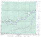
Maps showing Crooked Rapids, 5-88-12-W4, Alberta
Crooked Rapids is a Rapids located in 5-88-12-W4, Alberta and has an elevation of 331 meters.
- Latitude: 56° 35' 58'' North (decimal: 56.5994444)
- Longitude: 111° 51' 47'' West (decimal: -111.8630556)
- Topography Feature Category: Rapids
- Geographical Feature: Rapids
- Canadian Province/Territory: Alberta
- Elevation: 331 meters
- Location: 5-88-12-W4
- Atlas of Canada Locator Map: Crooked Rapids
- GPS Coordinate Locator Map: Crooked Rapids Lat/Long
Crooked Rapids NTS Map Sheets