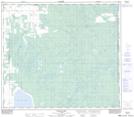
Maps showing Crowell, 1-79-20-W5, Alberta
Crowell is a Unincorporated area located in 1-79-20-W5, Alberta and has an elevation of 640 meters.
- Latitude: 55° 49' 20'' North (decimal: 55.8222222)
- Longitude: 116° 58' 36'' West (decimal: -116.9766667)
- Topography Feature Category: Unincorporated area
- Geographical Feature: Railway Point
- Canadian Province/Territory: Alberta
- Elevation: 640 meters
- Location: 1-79-20-W5
- Atlas of Canada Locator Map: Crowell
- GPS Coordinate Locator Map: Crowell Lat/Long
Crowell NTS Map Sheets