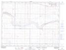
Maps showing Crow Indian Lake, 5-13-W4, Alberta
Crow Indian Lake is a Lake located in 5-13-W4, Alberta and has an elevation of 885 meters.
- Latitude: 49° 22' 11'' North (decimal: 49.3697221)
- Longitude: 111° 47' 3'' West (decimal: -111.7841667)
- Topography Feature Category: Lake
- Geographical Feature: Lake
- Canadian Province/Territory: Alberta
- Elevation: 885 meters
- Location: 5-13-W4
- Atlas of Canada Locator Map: Crow Indian Lake
- GPS Coordinate Locator Map: Crow Indian Lake Lat/Long