Maps showing Culp, 17-78-23-W5, Alberta
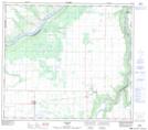
Culp is a Unincorporated area located in 17-78-23-W5, Alberta and has an elevation of 556 meters.
- Latitude: 55° 45' 8'' North (decimal: 55.7522222)
- Longitude: 117° 32' 46'' West (decimal: -117.5461111)
- Topography Feature Category: Unincorporated area
- Geographical Feature: Locality
- Canadian Province/Territory: Alberta
- Elevation: 556 meters
- Location: 17-78-23-W5
- Atlas of Canada Locator Map: Culp
- GPS Coordinate Locator Map: Culp Lat/Long