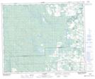
Maps showing Cynthia, 32-49-10-W5, Alberta
Cynthia is a Unincorporated area located in 32-49-10-W5, Alberta and has an elevation of 918 meters.
- Latitude: 53° 16' 58'' North (decimal: 53.2827778)
- Longitude: 115° 25' 22'' West (decimal: -115.4227778)
- Topography Feature Category: Unincorporated area
- Geographical Feature: Hamlet
- Canadian Province/Territory: Alberta
- Elevation: 918 meters
- Location: 32-49-10-W5
- Atlas of Canada Locator Map: Cynthia
- GPS Coordinate Locator Map: Cynthia Lat/Long
Cynthia NTS Map Sheets