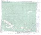
Maps showing Daniels Flats, 58-7,8-W6, Alberta
Daniels Flats is a Beach located in 58-7,8-W6, Alberta and has an elevation of 923 meters.
- Latitude: 54° 1' 25'' North (decimal: 54.0236110)
- Longitude: 119° 3' 5'' West (decimal: -119.0513889)
- Topography Feature Category: Beach
- Geographical Feature: Flats
- Canadian Province/Territory: Alberta
- Elevation: 923 meters
- Location: 58-7,8-W6
- Atlas of Canada Locator Map: Daniels Flats
- GPS Coordinate Locator Map: Daniels Flats Lat/Long
Daniels Flats NTS Map Sheets