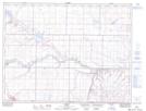
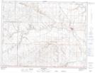
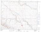
Maps showing Verdigris Coulee, 4-16-W4, Alberta
Verdigris Coulee is a Valley located in 4-16-W4, Alberta and has an elevation of 987 meters.
- Latitude: 49° 6' 35'' North (decimal: 49.1096390)
- Longitude: 111° 45' 27'' West (decimal: -111.7574439)
- Topography Feature Category: Valley
- Geographical Feature: Coulee
- Canadian Province/Territory: Alberta
- Elevation: 987 meters
- Location: 4-16-W4
- Atlas of Canada Locator Map: Verdigris Coulee
- GPS Coordinate Locator Map: Verdigris Coulee Lat/Long
Verdigris Coulee NTS Map Sheets