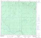
Maps showing Twin Lakes, 20,29-97-22-W5, Alberta
Twin Lakes is a Lake located in 20,29-97-22-W5, Alberta and has an elevation of 714 meters.
- Latitude: 57° 26' 30'' North (decimal: 57.4416667)
- Longitude: 117° 32' 25'' West (decimal: -117.5402778)
- Topography Feature Category: Lake
- Geographical Feature: Lakes
- Canadian Province/Territory: Alberta
- Elevation: 714 meters
- Location: 20,29-97-22-W5
- Atlas of Canada Locator Map: Twin Lakes
- GPS Coordinate Locator Map: Twin Lakes Lat/Long
Twin Lakes NTS Map Sheets