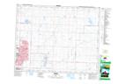
Maps showing Twin Lakes, 10-26-28-W4, Alberta
Twin Lakes is a Lake located in 10-26-28-W4, Alberta and has an elevation of 1065 meters.
- Latitude: 51° 12' 27'' North (decimal: 51.2074999)
- Longitude: 113° 50' 5'' West (decimal: -113.8347222)
- Topography Feature Category: Lake
- Geographical Feature: Lakes
- Canadian Province/Territory: Alberta
- Elevation: 1065 meters
- Location: 10-26-28-W4
- Atlas of Canada Locator Map: Twin Lakes
- GPS Coordinate Locator Map: Twin Lakes Lat/Long