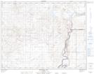
Maps showing Twin Peaks, 16-5-W4, Alberta
Twin Peaks is a Mountain located in 16-5-W4, Alberta and has an elevation of 748 meters.
- Latitude: 50° 23' 54'' North (decimal: 50.3983333)
- Longitude: 110° 38' 57'' West (decimal: -110.6491666)
- Topography Feature Category: Mountain
- Geographical Feature: Peaks
- Canadian Province/Territory: Alberta
- Elevation: 748 meters
- Location: 16-5-W4
- Atlas of Canada Locator Map: Twin Peaks
- GPS Coordinate Locator Map: Twin Peaks Lat/Long
Twin Peaks NTS Map Sheets