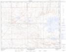
Maps showing Watkins Slough, 26,35-13-4-W4, Alberta
Watkins Slough is a Lake located in 26,35-13-4-W4, Alberta and has an elevation of 753 meters.
- Latitude: 50° 7' 12'' North (decimal: 50.1200000)
- Longitude: 110° 27' 30'' West (decimal: -110.4583333)
- Topography Feature Category: Lake
- Geographical Feature: Slough
- Canadian Province/Territory: Alberta
- Elevation: 753 meters
- Location: 26,35-13-4-W4
- Atlas of Canada Locator Map: Watkins Slough
- GPS Coordinate Locator Map: Watkins Slough Lat/Long
Watkins Slough NTS Map Sheets