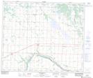
Maps showing Weasel Creek, 9-60-20-W4, Alberta
Weasel Creek is a Unincorporated area located in 9-60-20-W4, Alberta and has an elevation of 655 meters.
- Latitude: 54° 10' 49'' North (decimal: 54.1802778)
- Longitude: 112° 55' 28'' West (decimal: -112.9244443)
- Topography Feature Category: Unincorporated area
- Geographical Feature: Locality
- Canadian Province/Territory: Alberta
- Elevation: 655 meters
- Location: 9-60-20-W4
- Atlas of Canada Locator Map: Weasel Creek
- GPS Coordinate Locator Map: Weasel Creek Lat/Long
Weasel Creek NTS Map Sheets