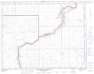
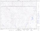
Maps showing White Horse Lake, 20-4-W4, Alberta
White Horse Lake is a Lake located in 20-4-W4, Alberta and has an elevation of 639 meters.
- Latitude: 50° 39' 52'' North (decimal: 50.6644444)
- Longitude: 110° 29' 24'' West (decimal: -110.4899999)
- Topography Feature Category: Lake
- Geographical Feature: Lake
- Canadian Province/Territory: Alberta
- Elevation: 639 meters
- Location: 20-4-W4
- Atlas of Canada Locator Map: White Horse Lake
- GPS Coordinate Locator Map: White Horse Lake Lat/Long
White Horse Lake NTS Map Sheets