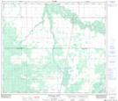
Maps showing Whitemud Creek, 1-75-23-W5, Alberta
Whitemud Creek is a Unincorporated area located in 1-75-23-W5, Alberta and has an elevation of 582 meters.
- Latitude: 55° 27' 49'' North (decimal: 55.4636111)
- Longitude: 117° 24' 54'' West (decimal: -117.4150000)
- Topography Feature Category: Unincorporated area
- Geographical Feature: Locality
- Canadian Province/Territory: Alberta
- Elevation: 582 meters
- Location: 1-75-23-W5
- Atlas of Canada Locator Map: Whitemud Creek
- GPS Coordinate Locator Map: Whitemud Creek Lat/Long
Whitemud Creek NTS Map Sheets