Maps showing Whitla Coulee, 3-10-8-W4, Alberta
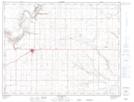
Whitla Coulee is a Valley located in 3-10-8-W4, Alberta and has an elevation of 842 meters.
- Latitude: 49° 47' 36'' North (decimal: 49.7933333)
- Longitude: 111° 0' 24'' West (decimal: -111.0066666)
- Topography Feature Category: Valley
- Geographical Feature: Coulee
- Canadian Province/Territory: Alberta
- Elevation: 842 meters
- Location: 3-10-8-W4
- Atlas of Canada Locator Map: Whitla Coulee
- GPS Coordinate Locator Map: Whitla Coulee Lat/Long
Whitla Coulee NTS Map Sheets