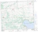
Maps showing Wenham Valley, 10-47-3-W5, Alberta
Wenham Valley is a Unincorporated area located in 10-47-3-W5, Alberta and has an elevation of 910 meters.
- Latitude: 53° 2' 45'' North (decimal: 53.0458333)
- Longitude: 114° 20' 40'' West (decimal: -114.3444443)
- Topography Feature Category: Unincorporated area
- Geographical Feature: Locality
- Canadian Province/Territory: Alberta
- Elevation: 910 meters
- Location: 10-47-3-W5
- Atlas of Canada Locator Map: Wenham Valley
- GPS Coordinate Locator Map: Wenham Valley Lat/Long
Wenham Valley NTS Map Sheets