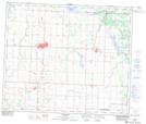
Maps showing Westlock, 5-60-26-W4, Alberta
Westlock is a Town located in 5-60-26-W4, Alberta and has an elevation of 654 meters.
- Latitude: 54° 9' 19'' North (decimal: 54.1552777)
- Longitude: 113° 51' 25'' West (decimal: -113.8569444)
- Topography Feature Category: Town
- Geographical Feature: Town
- Canadian Province/Territory: Alberta
- Elevation: 654 meters
- Location: 5-60-26-W4
- Atlas of Canada Locator Map: Westlock
- GPS Coordinate Locator Map: Westlock Lat/Long